Thursday, November 16, 2017

Kurugodu, Bellary - Fort, Prehistoric Paintings and Ancient Temples


Kurugodu, Bellary - Fort, Prehistoric Paintings and Ancient temples
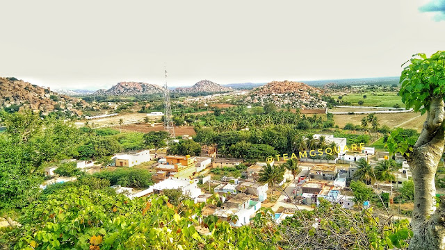
A Panoramic View of Kurugodu Fort, Town and Hills
Though traveling to Kurugodu was fairly regular when I was in Bellary, we could never manage to make enough time for exploring this place. The 'Hill Fort of 'Kurugodu' has always been inviting and many of our travel and historical books speak in volumes about it. The level of eagerness to explore Kurugodu reached its highest at one point and culminated with us planning a road trip to Bellary during the holidays of Deepavali, last year. Trust us! This place undoubtedly exceeded our expectations. Our previous day was quite exciting, with the highlight of the day being the prehistoric anthropomorphic sites of Kumathi and Hulikunte. This day, we planned to explore the prehistoric sites of Sanganakallu and Kuppagallu and in anticipation of a really hot day, we started quite early and reached Sanganakallu. As Mr. Ramadasa, our guide for the day who knew every stone of Sanganakallu was held up with other work and promised to meet us the next day, we decided to go ahead to the next place on our list, Kurugodu.
Shiva Mandapa, Kurugodu Fort
A Bird's Eye View of Shiva Mandapa 
History of Kurugodu and Kurugodu Fort: Kurugodu is believed to have been a part of the Kishkindha kingdom ruled by the monkey brothers Vali and Sugreeva during the Treta Yuga (period when Lord Rama ruled the earth). Later in the Dwapara Yuga, this place became the capital of the Kuntala kingdom ruled by the great king Chandrahasa. The town of Kurugodu, surrounded by many small hillocks, proved an ideal environment for the then prehistoric settlement. There is ample evidence given by archaeologists in the form of artifacts to prove that this site was once occupied by prehistoric men. A few cave paintings found here can be traced back to the Bronze Age, with the others belonging to the Iron Age. Though there are no records of Kurugodu's association with the Mauryan empire, findings from the Ashokan edicts at Nittur and Udegola which are in close proximity to Kurugodu confirm that Kurugodu was once under the rule of the Mauryan kingdom. An inscription found here dated to around 2nd century AD confirms that this place was also under the rule of the Satavahanas between 2nd and 3rd centuries AD. Subsequently, it came under the control of the Badami Chalukyas after which it gave rise to one of the lesser know dynasty, the Sindhs of Kurugodu. The Sindhs ruled Kurugodu from 7th century till the end of the 12th century, with their descendants seen living even now at Kurugodu. King Ariballi Dagra established the Kurugodu Sindh Kingdom followed by Udayaditya, Chokarasa, Rachamalla I (the most successful king of this dynasty), Rachamalla II and Veerakalidevarasi. The fort of Kurugodu was built by the Sindh kings way back in the 10th century and was later improved by the Vijayanagara Kings. This fort is four tiered, with its bottom most tier of fortification encircling the entire town of Kurugodu and its surrounding hillocks. At a later stage, Hyder Ali captured this fort and post the death of Tippu Sultan, it was left abandoned.
Kurugodu Fort
Kurugodu Fort Walls
Bird's Eye View of Hale Kurugodu
Tungabhadra canal
Tungabhadra Canal Traversing Across Paddy Fields
Kurugodu Fort
Kurugodu Fort
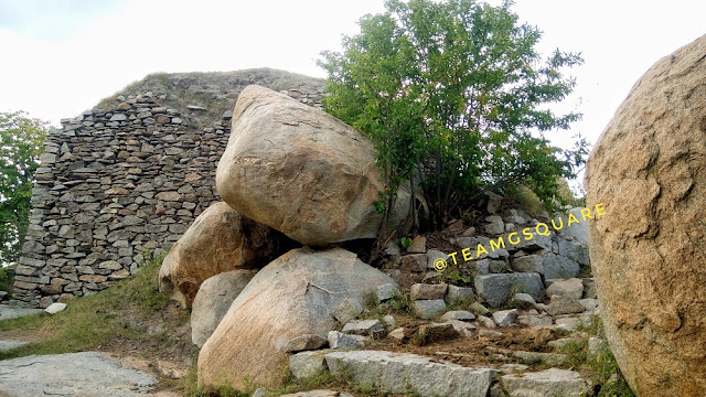
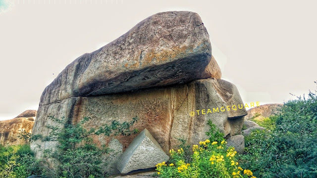
Having been to Kurugodu many times and hence being familiar with its surroundings, we easily found a decent place to park our vehicle and reached the base of the hill. Hereon, two men volunteered to accompany us and guide us along. They informed us about the presence of two routes, one laid with proper steps and the other with a rough path through thorny shrubs, which turned slippery at times. For us, taking the the tougher route was quite an obvious choice. The climb was slightly difficult, though a short one and we reached the first tier of fortification from where there were two diversions, one leading to the Shiva mandapa and the second to the next level of fortification. Reaching Shiva mandapa was quite tricky. It is a small mandapa housing a beautiful Shiva Linga, installed by the Sindh kings who were staunch followers of Veerashaiva dharma. The climb from here towards the second tier was quite easy. There is a temple dedicated to Lord Anjaneya with an inscription carved on stone, of the Vijayanagara Kings. From the top of this hill, we were able to spot many temples on the other side of Kurugodu, and upon inquiring, our guide informed us about Hale Kurugodu or Old Kurugodu, which was once a prosperous town under the Sindhs, but now is in ruins and shambles. They gave us all the details of the temples there. We explored the remains of the fort, most of which were still intact. There are many interesting balancing rocks here. Our descent was quick and we asked our guides if they were also interested in showing us around Hale Kurugodu. Their response was negative and they also went on to advise us not to explore that side of the place as it had turned into a drunkards den and would be unsafe. We thanked our guide and bade them good bye. We stopped by a small shop to buy some snacks and prepare food for our little one. We bought a few fruits here for which Kurugodu is known for. Kurugodu and its surroundings are well known for the excellent quality of Pomegranate, Fig and Papaya they grow, most of which are exported.
Kurugodu Fort
Balancing Rock inside Kurugodu Fort
An Inscription Outside Lord Anjaneya Temple 
Lord anjaneya inside Kurugodu Fort
Lord Anjaneya
Balancing Act by Rocks
Kurugodu Fort
Lord Anjaneya Temple and Fort Walls
Lord Shiva, Kurugodu Fort
Lord Shiva
We decided to explore the temples which we saw from atop the hill and proceeded further. We found ruins of many temples here and a little further on a rock we spotted some red colored paintings. We parked our vehicle to investigate the place and to our surprise, they were indeed prehistoric paintings. We were able to identify the paintings of hyena, bulls, people and many other worn out paintings. So excited we were! It seemed for a second like it was our own discovery! We explored more around this area with an expectation of finding other paintings, but no luck. There was a person working nearby this site and on inquiring him about the presence of any other such paintings around, he looked blank and admitted of being totally unaware about them. HeyI requested him to come along to the rock where we saw the paintings to know if he could recollect having seen similar paintings elsewhere, but his answer was negative. He went on to confess that he never knew about these paintings and its significance, but will keep in mind the same from now on. He suggested us to see a cave temple with some carvings of kings a little further. We thanked him and carried on with our explorations.
Prehistoric Rock Shelter, Hale Kurugodu
Prehistoric Cup-marks , Bellary
Prehistoric Cup-marks 
Prehistoric cave painting, Kurugodu, Bellary
Painting Depicting Hyena 
Prehistoric cave painting, Kurugodu, Bellary
Unidentifiable Cave Paintings
 To be continued….. 


Related Posts:
Rock Carvings of Usgalimal

Thursday, November 9, 2017

Gudekote, Bellary - Cave Paintings, Fort and Bear Sanctuary

Gudekote Fort
Exploring Gudekote Fort with our Young Trekker
'Gudekote' is a small town situated on the Bellary/Ballari - Kudligi State Highway. As usual, having passed by this place many a time, we had an urge to visit here but never got a chance to do so. Finally during the last year Dasara holidays, we managed to plan a visit to this place. It was quite hectic and we started the day by exploring the Fort at Ramadurga, Shree Ramalingeshwara Cave Temple, Nayakanahatti Temple and the Prehistoric Sites of Kumathi and Hulikunte. We reached Gudekote around 4.15 pm and were contemplating whether or not to climb the hill fort as this place has been declared as a bear sanctuary. We inquired at a few places and found it safe to climb the hill and decided to give it a shot. We parked our vehicle and walked towards the hill in pursuit of another exciting adventure.
Gudekote, Bellary, Karnataka
Four of the Five Hills surrounding Gudekote as viewed from the Doregala Hill
Birdseye View of Gudekote
Bird's Eye View of Gudekote
History of Gudekote and Fort: Gudekote is derived from two Kannada words, 'Gudi' meaning  Temple and 'Kote' meaning Fort. Hence, Gudekote literally means a Temple-Fort. There are 5 hills surrounding the town of Gudekote namely, the Doregala Gudda, Someshwara Gudda, Agasara Gudda, Harijana Keri Gudda and Karadi Gudda. Gudekote was occupied since the Neolithic period, and many prehistoric artifacts have been discovered by researchers here. Later this place is said to have been under the rule of the Mauryan dynasty, based on the Ashokan edicts found at Brahmagiri, Ashoka Siddapura and Jatinga Rameshwara. It then came under the rule of the Satavahanas, the Kadambas, Badami Chalukyas, Rashtrakutas, Kalyana Chalukyas, Hoysalas and the Palegars (chieftains) of Hosamaledurga. Subsequently, the Gudekote Palegars under the patronage of Vijayanagara Kings ruled this place between 1506 AD and 1757 AD and gave a tough fight to the Bahmani dynasty. King Gundala Nayaka established the Gudekote Palegar Kingdom, followed by Bommatharaja, Chinnayaraja, Immadi Rajjappanayaka, Jatingi Raja, Ramappanayaka, and Shivappa Nayak. The Gudekote Palegars improved the mud fort here by replacing it with a strong stone fort during the 16th century. This place was captured by Hyder Ali and later went fell into the hands of the British with the defeat of Tippu Sultan, who had control over this place till 1947 which later was added to the then state of  Mysore.
Gudekote Fort Trek
The Initial Climb
The Young Trekker Growing out of Shadows
After a short climb, we reached a site that seemed like a prehistoric settlement or rather would have been a perfect place to have one! The cave paintings here only confirmed that this site indeed was a prehistoric settlement. Though most of the cave paintings have been vandalized by modern graffiti, we were able to identify a few, with most of the remains seeming no less than a puzzle! The paintings were similar to the ones at  Jatinga Rameshwara and Anegundi, and hence must have belonged to the same period. We spent quite a good time here trying to decipher these paintings, as it always arouses the sense of creativity, imagination and humor in us. Deciphering paintings has always been a fun activity and hence we enjoy it. After a while, we proceeded further.
Prehistoric paintings Gudekote
Cave Paintings
Prehistoric rock shelter Gudekote Bellary
Cave Paintings and The Rock Shelter
Gudekote, Forts of Karnataka
Gudekote Fort
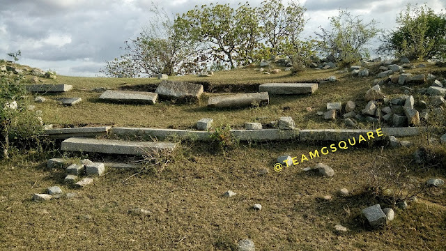
We were greeted by the first tier of the fortification which opens into a flat land, perfect to have a settlement. There were remains of a few buildings and also a stepped well. On exploring the area, we found another building structure of a much later stage, probably built by the British. This place seemed like a storage place for food, being devoid of any doors. We found a unique carving on a rock further, resembling that of a soldier with a spear in hand, and with very assertive and alert eyes! We continued our climb further only to realize that there was no clear path hereon, except a few ruins spread here and there. We settled here for a few minutes while the sun was setting behind us and after sometime started our descent. We reached the village and went straight to explore the Tangalli Mahal built in Indo-Islamic style by the Palegars  and  enjoyed the cool breeze there. This must have been a grand two storey structure which sadly today is in shambles. The hills and forests around Gudekote have been declared as a 'Sloth Bear Sanctuary', according to a notification of 2013 and second only such wildlife sanctuary after the Daroji Bear Sanctuary near Hampi of Bellary district.  This however, is yet to be opened for visitors and is considered to be larger than Daroji.
Gudekote fort entrance
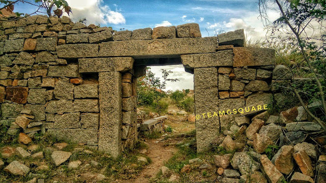
2nd Fort Gateway of Gudekote
Stepped Well Inside Gudekote Fort
Dried Stepped Well Inside Gudekote Fort
Stepped Well, Gudekote, Bellary, Karnataka
Another Dried Stepped Well
Carving, Gudkeote fort, Bellary, Karnataka
Unique Carving
Gudekote, Forts of India
Ruins Inside Gudekote Fort
Store house, Gudekote Fort, Bellary, Karnataka
Store House Probably Built by the British
We also remember seeing a few rock paintings on the Gudekote - Bellary road during our other travels. Being very curious each time we saw them, we decided to check out what was in store this time and reached that spot, which falls inside the limits of a Bear Sanctuary. There were a few unique cave paintings under rock-shelters which were quite difficult to decipher. The sunset was an indication to end the day's adventure. It was a great day, one of those where we explored 2 forts, a beautiful cave temple, a popular local pilgrim center and 3 prehistoric sites. Hereon, we drove towards Bellary for our next adventure.
Tangalli Mahal, Gudekote, Bellary
Tangalli Mahal
Gudekote Bear Sanctuary Karnataka
Prehistoric Rock Shelter With Paintings
How to reach Gudekote: Located on the Bellary - Kudligi road, it is about 60 km from Bellary and 30 km from Kudligi. 
Accommodation: There are no options available for accommodation in Gudekote. One can stay at Kudligi which has limited options, however the best would be to find a stay in Bellary overnight. Our usual place of halt is Hotel Ashoka Residency with an affordable budget.
Places to Visit Around Gudekote: Sandur, Kudligi, Kotturu, Ujjaini, BrahmagiriAshoka Siddapura, Jatinga Rameshwara, Sanganakallu, Bellary, Hampi, Nayakanahatti, Kumathi, Hulikunte and many such.

References:
1. Book on "Ballari Jilleya KotegaLu" By Dr.M.Kotresh
2. Journeys Across Karnataka

Related Posts:
1. Channarayana Durga Fort
2. Ambajidurga Fort
3. Kavaledurga Fort 
4. Rock Engraving of Usgalimal 

Wednesday, November 1, 2017

Moonbow at Unchalli Waterfalls, Sirsi

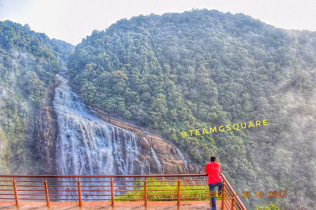
Unchalli waterfalls, Siddapura Uttara Kannada
Unchalli Waterfalls
Sometime back,  having read about the phenomenon of a Moonbow or Lunar Rainbow occurring at a few waterfalls around the world, we wondered if we would ever get an opportunity to witness this rare phenomenon. The chances seemed were very minimal or nil, owing to the locations of its occurrence previously. The formation of Moonbow has been documented in 5 locations of waterfalls throughout the world so far, though there could be many such places where the Moonbow would form. One and only such place documented in Asia is our favorite waterfalls of Unchalli. We have the privilege of visiting Unchalli quite often, as Sirsi is always on our annual pilgrimage tour. This year however, we were unable to visit Sirsi earlier due to various reasons. Somehow, we got a chance for a quick visit to this place during the last weekend. As we wanted to visit Unchalli falls in the evening, we had to meet a few locals whom we knew from our previous visits and seek help to get the required permission.
Moonbow Unchalli Waterfalls
Note the Faint Moon Bow
Moonbow Unchalli Waterfalls
Chandra Dhanasu, Unchalli Falls
A Moonbow or Lunar Rainbow is a celestial phenomenon similar to the  usual rainbow, but formed only during moonlight. They are very rare in occurrence and invisible to the naked eye. Moonbows are very faint and believed to occur during a full-moon or bright-moon night. Though capturing them in the right angle is very difficult, there are a few who have been chasing Moonbows at Unchalli since a few years and have succeeded in documenting them only last year. As Unchalli waterfalls comes under the area of reserved forest, there are restrictions of movement during the night times and a strict ban is imposed on camping here. The locals were quite helpful in getting us the necessary permissions from the forest department for a late evening visit.
Moon Over unchalli Falls
Moon Over Unchalli Falls
I, along with my friends reached the house of the local friend around 6.45 pm that evening. Taking a moment to refresh, we quickly started our walk towards the view point of the waterfalls. Though that night was a half-moon night or Ashtami Chandra, the falls was clearly visible and we were enjoying our moonlit descent towards the view point. We made sure to be well equipped with torches to help us descend. The view from the watch tower was just splendid! The scene is indescribable in words or sentences! It  would easily convert any normal man into a poet. But I instead chose to photograph this spectacular scene, which was quite difficult due to the dim light. After a lot of trials, I  managed to get a couple of decent shots of the waterfall. While I zoomed in to take a look at the picture, I was shell shocked to see that we had additionally captured a Moonbow! A quite faint rainbow it is, but is yet so exciting to realize that very few people in Asia have ever been able to witness and capture it. Thoroughly and unbelievably excited I was! Holding the same excitement on reaching home and transferring the pictures to my system, I had a closer look just to reassure it was a Moonbow. I was happy that we were able to capture it on camera. Thus making Unchalli closer and dearer to us. Don't miss to stop by a short video tour on Unchalli waterfalls.
Trek at Unchalli Waterfalls ,Sirsi, Uttara Kannada
Descent to the Falls
Waterfalls of Karnataka
Unchalli Waterfalls

Our humble request to all is 'Please take prior permission from the concerned authorities before heading into the forest area during nights as it comes under reserve forest area'. Also, entry to the falls is prohibited after 6 pm. Remember not to litter the place and leave it as it is for others and future generations to enjoy. 
You can also read one of our experiences at this waterfalls here.

References:
1. Times of India
2. Landscape Wizards 
3. Time and Date 

Related Posts:
1. Neelakurinji - A rare bloom
2. Dandeli - Resting in the lap of Nature
3. Biking in heaven, Kodagu